Tag: navigation

Filter By:

Filter

SOLAS – Changes to Pilot Transfer Arrangements

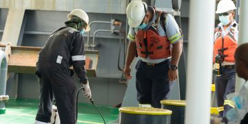
Amendments are due to enter into force on 1 July 2012. IMO Resolution 308(88), adopted in December 2010, made changes to the pilot transfer arrangements set out in SOLAS Chapter V/Regulation 23. The amendments are due to enter into force on 1 July 2012.The revised regulations apply to pilot boarding equipment and arrangements installed on or after the 1 July 2012. In the case of existing pilot boarding equipment and arrangements replaced on or after 1 July 2012, vessels are required to comply with the new regulatory requirements as far as reasonable and practicable. However, the amendment to Paragraph 6 which prohibits the use of mechanical pilot hoists applies to all vessels from 1 July 2012.Changes to SOLAS Regulation V/23Three new sub-paragraphs have been added to Paragraph 2 "General" concerning pilot ladder certification, identification and record keeping. Also a clarification as to what is meant by the term "accommodation ladder":2.3 A pilot ladder shall be certified by the manufacturer as complying with this regulation or with an international standard acceptable to the Organisation. Ladders shall be inspected in accordance with regulations I/6, 7 and 8.2.4 All pilot ladders used for pilot transfer shall be clearly identified with tags or other ...

Read more

South China Sea navigation not impeded by disputes

Freedom of navigation in the South China Sea has never been affected by the territorial disputes there, said China's Foreign Ministry, suggesting that US plans to expand its military presence in the region are inappropriate as Beijing has never thought of dominating any sea lane."Anyone objective can see that navigational freedom is fully guaranteed to every country in accordance with international law," said ministry spokesman Liu Weimin at a daily press conference on Monday.Liu also suggested the US back off from territorial disputes in the region as these "should be resolved via negotiations and consultations between countries directly concerned"."Hopefully, nations outside the area can respect the efforts of countries within the area to settle the disputes through bilateral negotiations, and avoid further involvement by any means," he added.China claims sovereignty over a number of islands in the South China Sea and its adjacent waters, bringing it into dispute with some countries, particularly Vietnam and the Philippines, which have similar claims.Speaking at an Asian security forum in Singapore over the weekend, US Defense Secretary Leon Panetta said Washington will shift a majority of its warships to the Asia-Pacific region by 2020.The move is seen by many, not least Chinese officials, as ...

Read more

Swedish patrol boats to install IBS

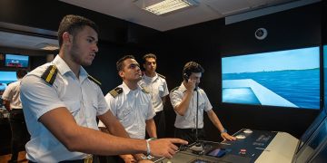
Integrated bridge systems (IBS) for the new class of patrol boats for the Swedish Coast Guard Sperry Marine reports that it is to supply integrated bridge systems (IBS) for the new class of patrol boats being built for the Swedish Coast Guard.The IBS for the patrol boats is based on the company's VisionMaster FT technology, which integrates the vessels' navigation and ship control functions within an Ethernet network.Each vessel will be equipped with three TotalWatch multifunction workstations, which include ECDIS, navigational radars, GPS positioning, autopilot, steering control and conning information. Voyage data recorders (VDR) will also be supplied to the ships.The contract includes five new vessels, with the first vessel, built by Baltic Workboats in Estonia, recently delivered to the Swedish Coast Guard.CA Clase Marinelektronik AB, Sperry's sales and service representative in Sweden, will provide technical support to the Swedish Coast Guard for the project."Our state-of-the-art navigation technology will provide optimum situational awareness for the ships' watch officers in carrying out their missions on these new patrol boats," said Hans Rasmussen, director of global business development, Sperry Marine.Source: The Digital Ship

Read more

Alaska Alternative Planning Criteria (APC)

From May 14, USCG will require compliance with APC The American P&I Club issues the following Circular regarding Alaska Alternative Planning Criteria:As from 14 May 2012, the US Coast Guard (USCG) will require compliance with new Alternative Planning Criteria (APC) for certain vessels operating in Western Alaska. Historically, it has not been possible for tank owners operating in Western Alaska carrying oil to comply fully with the vessel response planning requirements of the Oil Pollution Act 1990. In consequence, the USCG allowed waivers in respect of these requirements.However, in 2010, the USCG announced that shipowners would be required to fully comply with these regulations or adhere to approved Alternative Planning Criteria. On May 2011, the Alaska Marine Exchange publishedproposals for new Alternative Planning Criteria. The criteria have now been finalized.Accordingly, with effect from May 14, 2012, oil tank vessel owners and owners of vessels carrying oil as secondary cargo1 in certain areas of Western Alaska while going to or from a port in the United States will be required to comply with the new requirements. These areas are the areas of Western Alaska outside Cook Inlet and Prince William Sound regions and within 200 miles of the US coastline.The new ...

Read more
Chart updates by ECDIS console by USB save time

From the e-navigation firm Navtor A system that allows the most up to date electronic charts (ENCs) to be uploaded directly to an ECDIS console from a USB device has been announced by recent start-up e-navigation firm Navtor.In a conventional set-up, navigators have to work out exactly which ENCs they require for an upcoming voyage, order them in advance and then upload them from CDs that are posted out to them. Navtor argues this is an inefficient and needlessly time-consuming way of doing things and ripe for streamlining.The USB system, christened NavSync, has been developed to work in tandem with Navtor's recently launched pay-as-you-sail DNV-approved ENC service, which allows access to charts through a subscription-based model (see MITE Feb/Mar 2012).Navtor's Børge Hetland explains how it works: 'When a new subscriber signs up to our service, we distribute the ENCs on the NAVTOR NavSync USB compatible device, the NavStick. By using the USB port, ENCs can be installed in one simple operation, as opposed to loading multiple CDs. Updates can then be downloaded to the NavStick via any on-board PC with Internet connectivity and transferred to the ECDIS on a rolling basis.'As an added feature, NavSync also offers a print function ...

Read more

New Alaska navigational chart makes increased Arctic shipping safer

Kotzebue Harbor chart replaces measurements last taken in 19th century NOAA formally presented today to Alaska officials a new nautical chart for Kotzebue Sound in the Alaskan Arctic, a sparsely charted region that is seeing increased vessel traffic because of the significant loss of summer sea ice.The new chart depicts the full range of depth measurements and object detection acquired during a full ocean bottom survey last summer by the NOAA hydrographic survey ship Fairweather. It replaces a chart showing depth measurements last taken in the 19th century spaced three to five miles apart, leaving room for possible undetected dangers in between.The new navigational chart addresses a pressing need for this Northwest Alaska transportation hub, located in the Arctic Circle. Barge shipments and large transport ships must be anchored at least 14 miles out in the Kotzebue Sound due to shallow waters and inadequate charts and navigational aids. Freight must then be transferred by smaller barges to Kotzebue."This new chart is just one of the many critical navigational services that NOAA provides to support safe navigation and maritime commerce while protecting important marine resources," said Kathryn D. Sullivan, Ph.D., deputy NOAA administrator and assistant secretary of commerce for environmental observation ...

Read more

Lost at Sea

Can the Obama administration succeed where its predecessors failed on the Law of the Sea treaty? Few modern treaties have generated more domestic controversy for less reason than the United Nations Convention on the Law of the Sea. By codifying generous rights and freedoms of navigation throughout the world's oceans, the treaty promotes global trade, economic prosperity, and naval mobility. It is a commonsense guide to 71 percent of the Earth's surface, and for that reason it has been accepted by 161 nations, including Russia, China, France, and the United Kingdom. But not the United StatesSince the convention took effect in 1994, every U.S. president and Chief of Naval Operations has supported its ratification. In 2004 the Senate Foreign Relations Committee endorsed the Convention by a vote of 19 to 0; and in 2007, it approved the treaty by a vote of 17 to 4. But, because of staunch opposition from a handful of conservatives worried about what they say are threats to America's sovereignty, the treaty has never come up for a vote before the full U. S. Senate.Now, the Obama administration is trying to change that. On May 9, Secretary of Defense Leon Panetta and Chairman of the ...

Read more

Enviros look UNESCO for reef ship plan

How to better regulate ship traffic through the Great Barrier Reef Environmentalists are hopeful an international report will give the Queensland government ideas on how to better regulate ship traffic through the Great Barrier Reef.Bulk carrier ID Integrity lost power off the far north Queensland coast on Friday and narrowly avoided being run aground on Shark Reef.It passed safely over the reef and will likely be towed to Townsville on Monday, the Australian Maritime Safety Authority says.The Wilderness Society's northern Australia campaigner Gavan MacFadzean said he was hopeful UNESCO would detail some options about shipping regulations when it releases a report on the state of conservation in the Great Barrier Reef.'We look forward to seeing some recommendations which make traversing the reef by bulk carrier safer,' Mr MacFadzean told AAP on Monday.'(We hope they) make specific recommendations about how we're going to handle this big increase in ship movements and port developments.'The report, due to be released next week, will make recommendations about whether the reef should be listed as a World Heritage site in danger.UNESCO last year rebuked the Queensland and federal government for failing to inform it about two major liquefied natural gas projects on Curtis Island.Mr MacFadzean ...

Read more

Call for Great Barrier Reef shipping review

Review of how ships pass by the Great Barrier Reef Australian marine pilots on Monday called for a review of how ships pass by the Great Barrier Reef, warning of the risk of a major environmental disaster on the tourist attraction.Australian Reef Pilots, a firm with a century of experience in the region, raised its concerns after a Hong Kong-flagged bulk carrier broke down near the reef on Friday and drifted disabled for more than a day before it was secured.The company wants to see shipping routes restricted and the area where vessels must use pilots extended, moves which could prompt strong objections from foreign vessels accustomed to free passage."This is a second incident in about the last month where we've had a ship drifting outside the Great Barrier Reef but drifting towards it," Australian Reef Pilots chief executive Simon Meyjes told AFP."The biggest problem there is that they are in very deep water, they can't drop anchor to stop themselves drifting so they either have to fix their own problem or wait for help to come."Meyjes said in the latest incident, involving the 186-metre (610-foot), 45,000 tonne bulk carrier ID Integrity, it took close to 48 hours for tugs ...

Read more

Google plans to map the entire ocean floor over next five years

$3million on satellite technology Google is set to track the world's warships and make the data available to billions of internet users, raising concerns over the security of the American naval fleet.The search engine plans to offer the coordinates and identity of virtually all vessels at sea on Google Maps after spending around $3million on satellite technology.The company continues to consult with the U.S. Navy over the plans, as well as with the defence departments of countries around the world.Google has claimed that it is better placed to track the military boats than most governments.Ship-shape: Google will soon be able to show the location of every vessel at sea and maps of the ocean floorMichael Jones, who is chief technology advocate at Google Ventures, told Aol: 'I watch them and they can't see themselves. It angers me as a citizen that I can do this and the entire DoD can't.'Google is not the first to track ships at sea, but claims to have improved on previous technology.All large vessels are fitted with the Maritime Automatic Identification System (AIS) - a series of transponders that transmit the boat's position to avoid collisions when it is dark or there is bad weather.At ...

Read more
Page 35 of 41 1 34 35 36 41